mapping
Introduction to Mapping using QGIS
| «< Previous | Next »> |
Drawing a Polygon
To draw a Polygon:
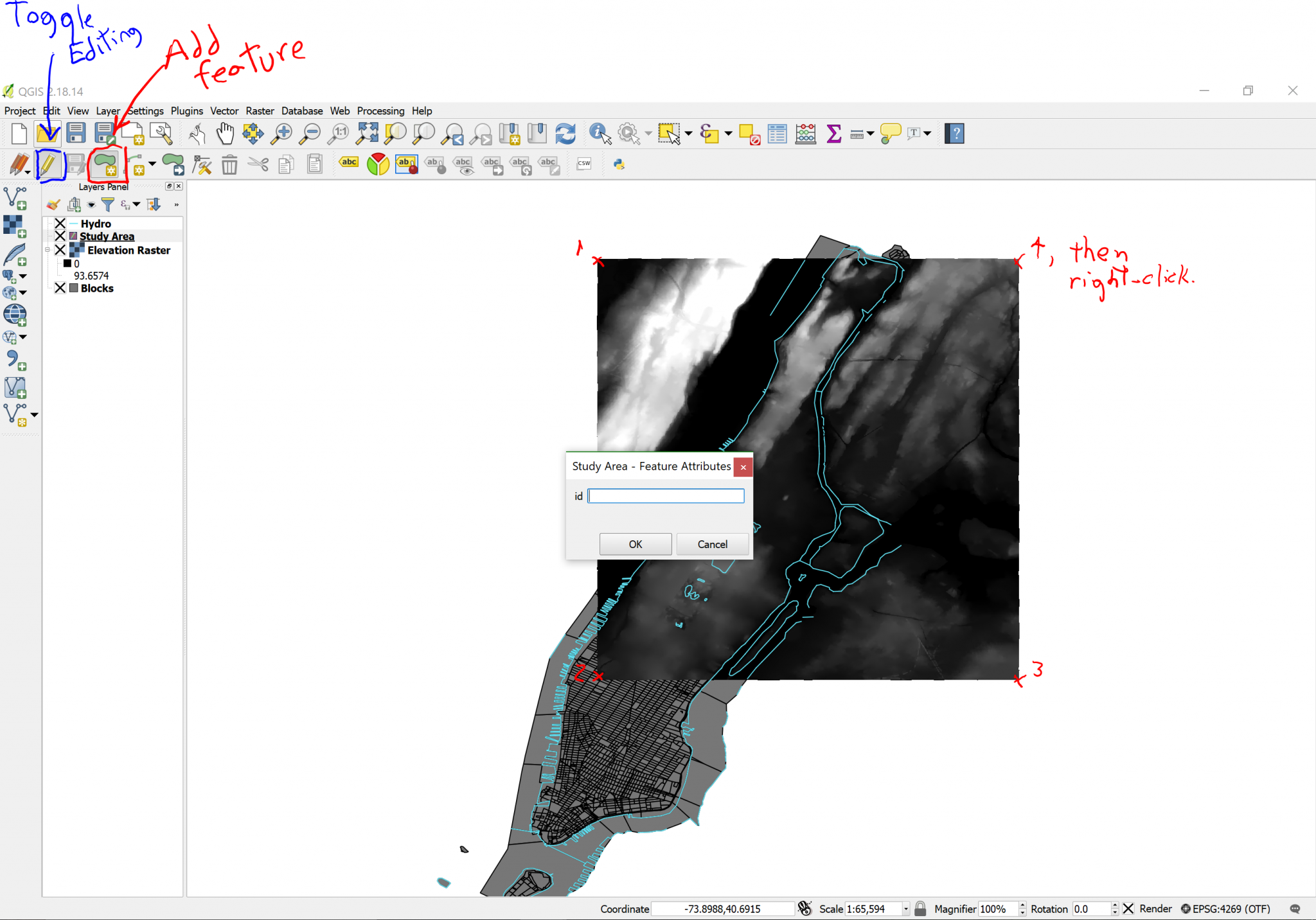
- Toggle editing mode on by clicking on the
Pencilicon (second icon from the left in the second toolbar). As you click on it, you will notice that previously greyed-out icons will be enabled. - Click on the
Add featurebutton (looks like a blob with a small yellow star to the right), which is located two icons to the right of theToggle editingbutton. Now your cursor is armed to draw. - Click on the upper-right corner of the raster image, then on the lower-right, then the lower-left and finally the upper left.
- Right-click to finish drawing.
- A box will pop-up asking you to write an id. Leave it blank and click
OK.
Don’t worry if you’re not super-precise; for this exercise we don’t need surgeon precision, we’re just practicing, exploring and learning. But if needed, there is a vertex tool to change the polygon vertices.
When you create a new layer, you have the option to indicate what attributes you would like the layer to have and you can fill it in as you create each point, line, or polygon.
A colored square will cover the whole raster image area. Since we don’t need to edit this layer further, click on the Toggle editing button again. A dialog will ask you if you want to save the changes, say yes.
| «< Previous | Next »> |